

| 🗺️ | Subject: understanding how a map of French regions helps to read terroirs and cultivation zones. |
| 🌱 | Key idea: an administrative region provides a framework, but the terroir is mainly read through climate, soil, and relief. |
| 📍 | Orientation: the map prevents confusing a political border with an agricultural or wine-growing basin. |
| 📊 | Official reference: France has 18 regions, including 13 in metropolitan France and 5 overseas since the reform that came into effect in 2016. |
| 🍇 | Practical use: compare production zones, dominant climates, and major landscape styles more quickly. |
| 🔎 | Practical angle: start from a map, then go down to departments, relief, and dominant crops. |
Sommaire
Zones of cultivation and terroirs: how the map of regions helps to better orient oneself
A map of French regions is not just for reciting names endlessly. It provides a first level of orientation very useful for reading an agricultural landscape, understanding where a terroir begins, and spotting why certain crops dominate here rather than there. Basically, it sets the scene before going into detail.

The classic trap is to believe that an administrative border tells the whole story. In reality, a region groups together climates, soils, and reliefs that can be very different. But without this initial framework, one quickly gets lost between the Paris Basin, Rhône Valley, Atlantic border, or Alsatian foothills. The map thus serves as a compass, not an absolute truth.
How does a map of regions help to read a terroir?
It provides an immediate overall reading: oceanic zones in the west, continental influences in the northeast, Mediterranean accent in the south, marked relief in the mountain ranges. In other words, the map helps link a space to its major natural constraints. This is the simplest starting point to understand why a crop is established here and not elsewhere.
For a reader seeking orientation, the benefit is very concrete. A region does not explain everything, but it already allows distinguishing the major families of agricultural landscapes: lowland cereals, bocage livestock farming, hillside vineyards, valley orchards, or drier Mediterranean crops. This is exactly what one looks for when moving from the map to the field.
If you want to follow the official limits without getting lost in the old divisions, the map of France departments and regions remains a good support point to move from the broad administrative framework to the detail of cultivation basins.
Why should we not confuse region, department, and terroir?
Because these three levels do not refer to the same thing. The region organizes the public space, the department still structures certain daily uses, and the terroir describes a much finer set, made up of soil, climate, slope, and local know-how. Mixing them risks a too quick, even misleading, interpretation.
| Reference | What it says | What it does not say |
|---|---|---|
| Region | A large administrative and geographical framework | The detail of soils or microclimates |
| Department | An intermediate level of management and orientation | The precise style of a local production |
| Terroir | A link between natural environment and human practices | A fixed political boundary |
| Appellation | An area recognized by a specifications document | All the diversity of a territory |
This distinction is particularly useful for food products, wines, or specialized crops. An appellation like AOP or AOC frames a zone, but it does not summarize an entire landscape. So one can be in the same administrative region without being in the same terroir, nor under the same production conditions.
An administrative map helps to orient oneself, but terroir is truly read when relief, climate, soils, and local practices are combined.
Which French regions provide the most meaningful references?
The most useful regions for orientation are those whose natural contrasts are striking: Brittany and the Atlantic coast, Grand Est and continental influences, Auvergne-Rhône-Alpes and reliefs, Provence-Alpes-Côte d’Azur and Mediterranean climate. These references do not replace a local study, but they help to quickly understand the major cultural logics.

In the South, the map is not only used to locate the Alps or the Mediterranean: it helps to understand why Provence, Occitanie, or the Rhône valley do not offer the same terroirs. Dry plateaus, wind corridors, altitude, and sunshine change the situation from one slope to another. This is where the map becomes truly concrete.

The logic resembles that found in highly regulated productions, where the starting environment already changes the final result. For example, one thinks of the standardized cultivation of mushrooms, where the environment, method, and production zone each play a precise role.
What criteria should be considered to read a cultivation zone on the map?
To accurately read a cultivation zone, you need to cross-reference four markers: the relief, the climate, the available water, and the dominant agricultural use. A region may appear homogeneous on a map, but its production basins change as soon as you go up in altitude, move away from the sea, or cross a narrow valley.
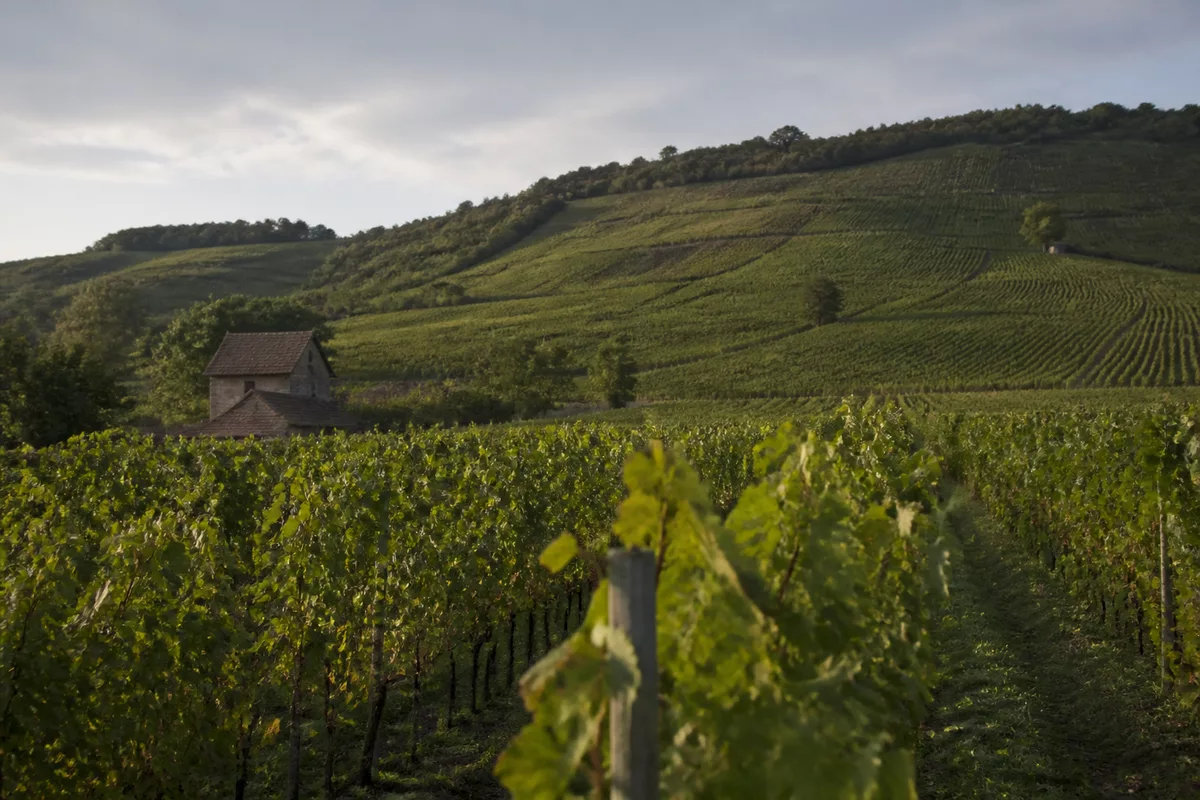
- The relief: plain, plateau, foothills, or mountain do not tell the same agricultural story.
- The climate: oceanic, continental, or Mediterranean, it determines the most suitable crops.
- The water: river, irrigation, soil moisture, or local drought alter the orientation of production.
- The exposure: a south-facing slope does not yield the same result as a north-facing slope.
- Land use: vineyards, cereals, livestock, orchards, or market gardening do not occupy the same spaces.
On a practical scale, these criteria are better than a purely political reading. For example, the same region can contain a very open large-scale farming area, a hillside wine-growing sector, and a more hedgerow-rich zone to the west. This is where the map of regions becomes a first filter, then it is necessary to refine with more local maps.
Orientation errors that distort the reading of a terroir
The first mistake is to take the map as an exhaustive summary. The second is to confuse a known product with its actual production area. The third, more subtle, is to neglect intermediate scales: a department, a valley, or a plateau can completely change the reading of the same territory.
In other words, the map does not replace the field: it mainly prevents you from confusing a political framework with a production zone.
- Do not confuse administrative region and agricultural basin.
- Do not assume that an appellation covers the entire regional territory.
- Do not ignore altitude, exposure, and wind corridors.
- Do not use an old map if the boundaries have changed.
For reading French regions, the 2015 reform remains an important reference because it changed the way space is named and mapped. According to the reference pages of Vie publique and the Ministry of the Interior, the current division was established with 13 regions in metropolitan France and 5 overseas. It is useful to keep this in mind if you compare old and recent documents.
How to use the map before choosing a terroir or a cultivation area?
The right method is simple: start with the region, then move down to the department, the relief, and finally the plot or production area. This zooming descent avoids shortcuts. It is useful both for a student and for someone looking for an agricultural location, a local product, or a reliable geographical reference.
- First identify the large climatic zone.
- Then look at the relief and valleys.
- Check the dominant productions around the targeted place.
- Finally, compare with the appellation boundaries or specialized cultivation zones.
This approach is particularly useful when you want to make a quick comparison between two territories. For example, between Brittany and Bourgogne-Franche-Comté, you are not just reading two different regions: you are also reading two agricultural logics, two climate exposures, and two ways of land use. The map provides the framework, then the terrain does the rest.

FAQ
Is an administrative region enough to understand a terroir?
No, not by itself. The region gives an overview, but the terroir depends mainly on the soil, climate, relief, and local practices. For a reliable reading, you always need to go down one level and look at the concrete production conditions.

What is the difference between terroir and appellation?
The terroir describes a broader natural and human ensemble, while an appellation defines a specific zone and a precise specification. An appellation can rely on a terroir, but it does not summarize all its nuances. It is a protection, not a complete snapshot of the landscape.
Why does the 2015 regional reform still matter today?
Because it changed administrative references and the maps used daily. To compare data, read an old document, or understand a cultivation area, you need to know whether you are talking about the pre- or post-2016 division. Without that, comparisons can quickly become shaky.
How to know if a map is useful to guide a local project?
It is useful if it helps you decide, not just locate a point. A good map must show the relief, major climatic influences, and, if possible, production or appellation zones. Otherwise, it remains pretty but not very practical.
Can you read a cultivation area without knowing all the departments?
Yes, and it is often more effective to start with the large units. Departments then serve to refine. For a first orientation, the most important thing is to understand the logics of climate, relief, and production basin, not to memorize all the administration at once.
